DI LandTrac
Drillinginfo's DI LandTrac Unified Land and Exploration Suite is the first fully integrated land and well information delivery system for the domestic U.S. oil and gas industry. DI LandTrac Suite is unifying, providing a single interface for land, production, and well information; for everyone in land, geology, engineering, and business and asset management.
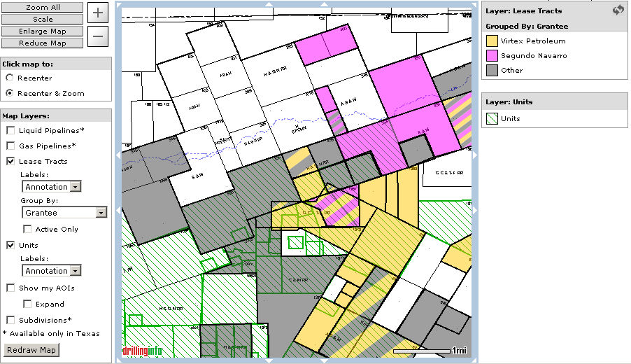
Drillinginfo now offers lease tract outlines in multiple states (including LA, TX, OK & NM) as well as unit outlines in TX. To add this feature to your account or find out the list of counties where this product is currently available please visit the Products page on Drillinginfo or contact sales (sales@drillinginfo.com).
To access DI LandTrac use the Optional Layers in the Map View:
Fore more information on Lease Tracts click here.
For more information on Unit Outlines click here.
For help exporting shape files click here.