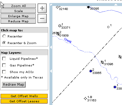
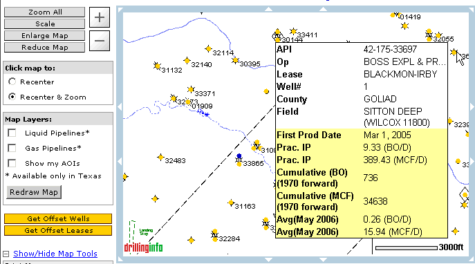
When the map view is at a scale of 1” = 3750’ or less, you can obtain the offset well information without returning to the Search Wizard. By clicking the Get Offset Wells link on the left side of the map, all wells in the visible area will be retrieved and displayed on the map. The offset wells are displayed as yellow dots. Placing your cursor over a well, or dot, will generate a pop-up hover window with general well information, much like the production hovers. An example is shown below. Note: if you did a Market View Search, the offset well data will have price data and will return one point per revenue stream. See Market View Search :
If you want to know more about the offset well, click on the well and a summary pop-up window will appear with information on other filings for the wellbore you are examining. An example is shown below:
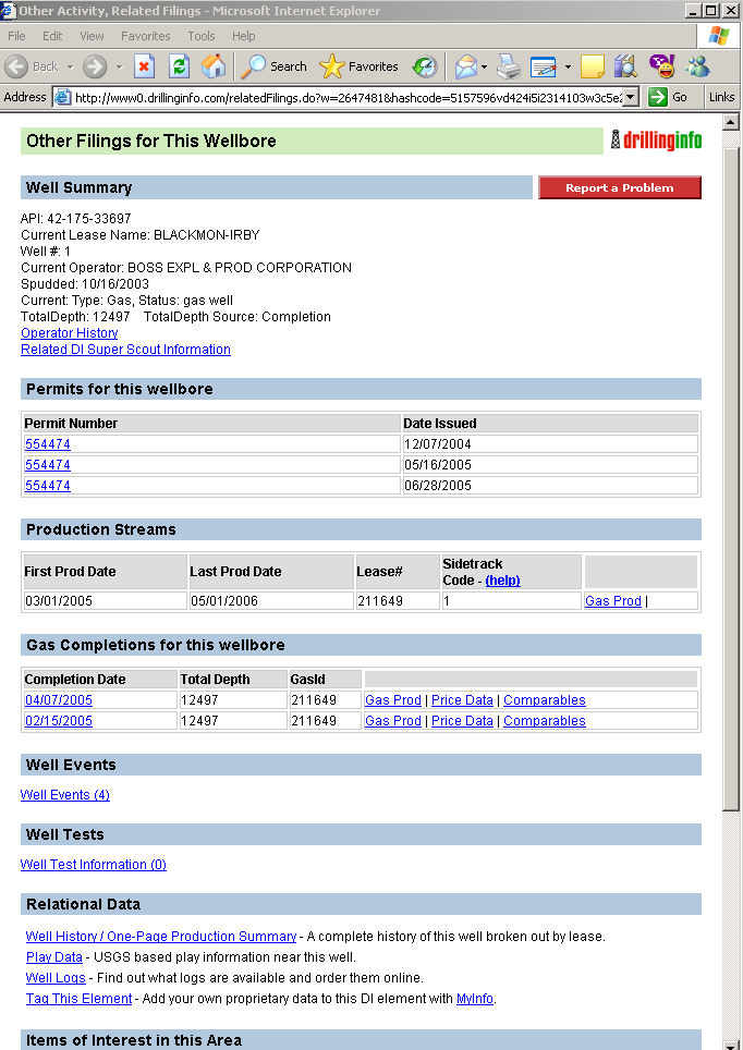
Current Type: Gas, Oil, Both or Unknown.
Status: Shows the current status of the well according to the RRC. Status could be Dry Hole, Gas Well, Oil Well, etc.
Permit: Links to the permit detail(s).
Oil/Gas Completions for this Wellbore: A link to the completion detail(s), production streams and other related well information.
Well Events: Links to well events filed for this wellbore, i.e. spudding, surface casing, etc.
Well Tests: Test information for this wellbore.
Relational Data: Links to the Well HIstory/One-Page Production Summary, Stratigraphic Column, Play Data, Well Logs, and MyInfo tags.