 option.
 Any map that is displayed on the screen can be printed as is, but to
account for differences in browsers, use the option.
DrillingInfo recommends using the  feature located in the Map Tools menu which
offers size and color options for a printed map.
feature located in the Map Tools menu which
offers size and color options for a printed map.
To print a DrillingInfo map please follow the steps below:
Click the  button from the Show/Hide Map Tools link
Select your print preferences
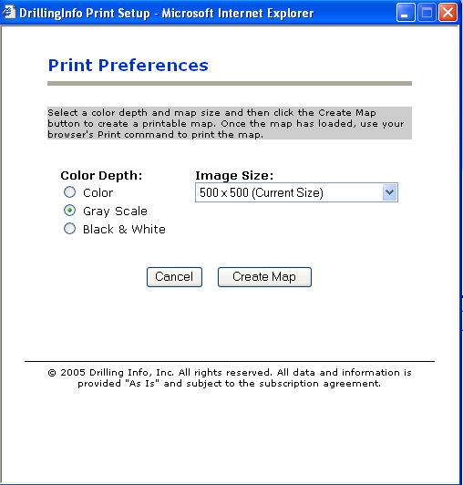
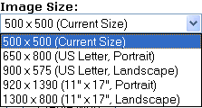
You may then select between Color, Gray Scale or Black & White. Next, chose an image size:
When ready, select 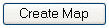 then use your browser’s print command to print the map. This
method produces a cleaner looking map.
then use your browser’s print command to print the map. This
method produces a cleaner looking map.
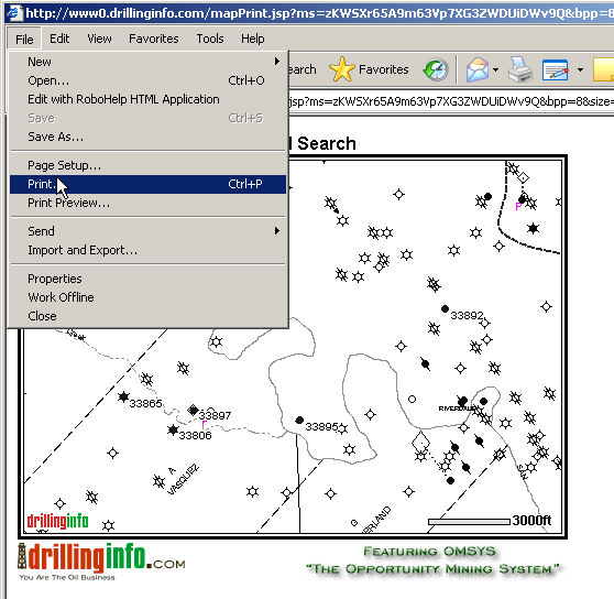
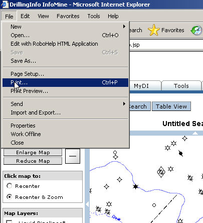
To print directly from screen, select <File> and <Print> from the menu.
TIP: For a titled map make sure
you click the  link to enter a title for you map.