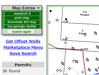
When the map view is at a scale of 1” = 3750’ or less, you can obtain the offset well information without returning to the Search Wizard. By clicking the Get Offset Wells link on the left side of the map, all wells in the visible area will be retrieved and displayed on the map. The offset wells are displayed as yellow dots. Placing your cursor over a well, or dot, will generate a pop-up hover window with general well information, much like the production hovers. An example is shown below. Note: if you did a Market View Search, the offset well data will have price data and will return one point per revenue stream. See Market View Search :

API: 42-175-33271
Op: Dominion Expl...
Lease: Koloozey
Well#: 2
Field: MISSION VALLEY, W.(WILCOX 10600)
County: GOLIAD
First Prod Date: 2000-09-01 00:00:00.0
Prac. IP: (BO/D)
Prac. IP: 1071.06 (MCF/D)
Cum Oil: 6072 (BO/D)
Cum Gas: 281971 (MCF/D)
Avg (August 2002): 9.32 (BO/D)
Avg (August 2002): 123.55 (MCF/D)
If you want to know more about the offset well, click on the well and a summary pop-up window will appear with information on other filings for the wellbore you are examining. An example is shown below:
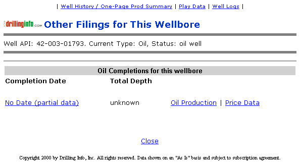
Current Type:
Status:
Oil Completions for this wellbore: