Wellevent driving directions etc;contractor utility w/TerraServer:
You have the ability to call a map from TerraServer that is centered on a point that you choose.
Simply click the TerraServer Image link in the lower right hand side of the map.
Click a location on the map and you will be taken to the TerraServer web site (http://terraserver.homeadvisor.msn.com) that contains the image of the point you chose.
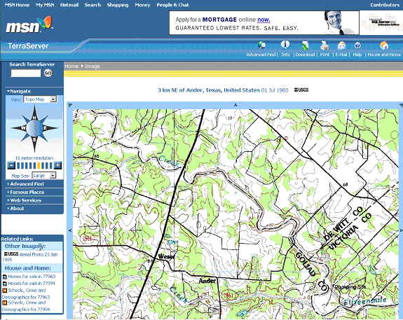
Next, when you reach the TerraServer web site you can use Advanced Find function.
Clicking the Advanced Find link in the top middle section of the page gives you the option of entering decimal latitude and longitude.
This will call a map centered on the lat-long you specified.
Choosing the large image option for either topo or aerial photo gives usable quality topo road maps, often with highway #s on them.
Therefore, if you are following any well events you should be able to find the permit, get the lat-long, download a large scale topo and aerial photo centered on the well, and then get the driving directions to rig from well event.
Of course you can get maps by clicking TerraServer without entering specific lat-long, but there may be some functionality in being able to specifically enter a lat-long.
(TerraServer also supports delivering maps, photos by street address, and if you call a topo, and then click on the Image Info link, you'll get degree gradations and x-y values)