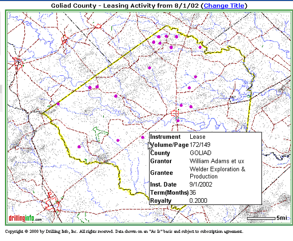
Leases are displayed on the map as purple dots. By placing your cursor over a lease symbol, or dot, a hover window will appear with general lease summary information. An example is shown below:
If you want to know more about the Lease, click on the lease symbol, and an Instrument Detail pop-up window will appear that allows you to find out more about the lease. An example is shown below:
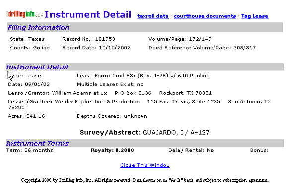
A description of the Instrument Detail follows:
Filing Information - critical information includes State, County, Record No. & Date, Volume / Page (of the instrument), and a Deed Reference for the lands covered by the instrument.
Instrument Detail - includes instrument type, the lease form (for oil and gas leases only), instrument date, whether or not multiple leases exist for this tract, Grantor, Grantee, Acres covered by the instrument, depths covered by the instrument, and the abstract descriptions of the lands covered by the instrument. In the case where an instrument covers multiple abstracts, it will show up at each abstract location on the map.
Instrument Terms - includes term of the instrument (in months). For leases, it includes the royalty and delay rental, whether or not there is an addendum, pooling restrictions, pugh clause, vertical termination, horizontal termination, and minimum royalty provisions. In addition, any remarks will be included.
Taxroll Data - this option allows you to obtain property tax information by clicking on one of the highlighted counties on the map.
Courthouse Documents - this option allows you to purchase and download scanned images of property records by clicking on one of the highlighted counties on the map.
Tag Lease - This feature is not fully functional at this time. Further information will be provided when fully activated.
Note: Because Leasing activity is not tied to wells, there is no Related Filings link.
See Map Help for more information.