Data is viewed in table or map form.
Your initial search will return a map posted with the data points you were searching. The map shows the largest geographic area that you requested (abstract, county, township, district, etc.).
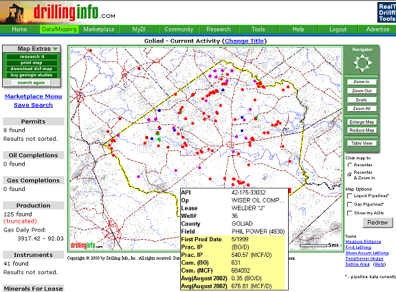
Example: Search for permits, completions, production, and leases located in Goliad County, Texas for the time period 10/01/2002 -10/31/2002. Shown below is the map that would be returned:
Here are some quick tips to using the map:
Active points are points returned by your search.
Click on a isolated active point to get the data.
Hover on a isolated active point to get summary data.
Click on a cluster of points and the map zooms way up to separate them
Click on a place in the map and the map centers and zooms about that point.
Use the Recenter radio button to make the map recenter only when you click on the map
For help with the functions of the map, click the items below:
For help with the following data maps, click the items below:
For help with the following eCommerce maps, click the items below: