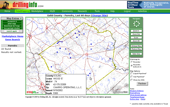
Permits are displayed on the map as blue dots. Placing your cursor over a permit well, or dot, will generate a pop-up hover window with general permit summary information. An example is shown below:
If you want to know more about the permit, click on the well or blue dot, and a Permit Summary pop-up window will appear that will allow you to find out more about the permit. An example is shown below:

A description of the links in the Permit Summary follows:
Permit Detail - Presents a facsimile of the original W-1 permit form for this permit. Example of permit:

Well History / One-Page Prod Summary - Takes you to the Well History/ Production Summary Hub as shown below. For a further discussion of the different links, see Production Maps.

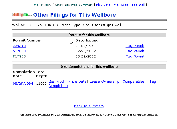
Related Filings - Shows other permit, completion information associated with this wellbore. For further information regarding the Completion links, see Completion Maps.
Strat Column - A generalized stratigraphic column for the area.
Play Data - A listing of known plays for this area, with accompanying play descriptions.
Well Logs - If Drillinginfo has well logs available for this well, then the related information will appear.
Well or Field Research - Listing of custom research services available.
Tag Permits/Tag Wells - This feature is not fully functional at this time. Further information will be provided when fully activated.
Here are some additional tips for the Permit tables:
Selecting a title for your map that states your search parameters (i.e. Goliad, Permits, 1/1/98-1/1/99) allows you to identify maps that you print.
Remember the Search Status Box to the left of the map allows you to track how much of the data you requested is being displayed. Searches that find more than 250 items will be truncated according to predetermined criteria. The criteria you can choose are either depth or county. To display the rest of the data, initiate a new search using the same criteria as the initial search but enter the deepest depth of the truncated data set plus one foot. For example, if you choose Depth as your truncation criteria, and permits from 0-7530 were displayed, start your new search with depths of 7531 and deeper.
After clicking on point or API and entering various hubs, use your back button on the browser to return to a previous section
See Map Help for more information.